
Your retrospective on the VOR (“The Day The Waypoints Died,” April 2012) was of interest in a reverse sort of way. I’m one of a few horse-and-buggy types who navigate by map-reading and compass alone, using VORs occasionally as a backup to map reading as opposed to a backup for GPS.
288
I just returned from a VFR trip in a Cessna 182 from British Columbia to San Francisco, then to Palm Springs, Lake Havasu, Las Vegas and back through eastern Nevada and Idaho, using lines drawn on two WAC charts (CF 16 and CF 18) and a protractor for heading.
Does anyone still fly to see the country as displayed on a sectional—lakes, rivers, mountains and valleys? I’ve always thought that the journey, not just the destination, was half the fun.
There’s still a sense of challenge and satisfaction flying the old way, and at least I’m not likely to get lost due to a navigation equipment failure.
Mort Doran
Fairmont, B.C.
We frequently find ourselves navigating via pilotage or dead reckoning in the area near our home base. Rarely, however, do we tune and identify a VOR. When we do, it’s usually to give ATC a better idea where we are when calling for service.
As one result, we wouldn’t want to be forced to shoot a VOR approach to minimums anytime soon, nor would we appreciate someone removing GPS from our cockpit.
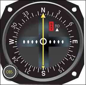
The article, of course, highlighted the growing lack of VOR skills among the pilot population as well as our ongoing dependence on GPS. There’s no question GPS has fostered a revolution in aviation navigation. At the same time, GPS is beginning to show its age, and there’s no replacement for it—at least of which we’re aware—on the drawing boards. The FAA’s reliance on GPS as the cornerstone of its NextGen navigation system is troubling to us, for these reasons.
Technical Error
In reading my regular hand-me-down copy of Aviation Safety magazine from my airplane partner, I noticed what I believe is an error in a technical explanation of the VOR signal.
288
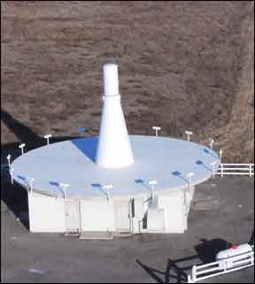
In the April 2012 article “The Day Waypoints Died,” the author explains that VOR is based on two signals; one referenced to north and one as-received on a given bearing. These pulsed signals were said to be time referenced to each other with the azimuth then being extracted. VOR does not use a time-referenced system. Rather, VOR uses several continuous signals, the 9960 frequency modulated “reference” signal and 30 Hz (nominal) “variable” signal.
Very simply stated, it is the phase relationship of these two signals at differing azimuths around the VOR station, as received by the aircraft, that are detected and resolved for the bearing information from the station.
What the author apparently did was state certain technical characteristics appropriate to the distance measuring (DME) portion (vice azimuth) of either a TACAN or VOR/DME system, whose signals are, of course, time referenced.
Thanks for providing a very useful publication.
Doran S. Platt, III
Monrovia, Md.
Thanks for the heads-up. You’re very likely correct that the article’s author commingled a technical description of VOR with one for DME/TACAN. Time is used in the DME calculation, whereas VOR compares the difference between two phase angles generated by the transmitter. We regret the error.
Meanwhile, thanks to your partner for sharing his copy, but don’t forget to subscribe to receive your very own each month.


